While the bad weather continues,
So continuing on from yesterday’s post, it does seem like I am running a little “late” on the trail and winter might be arriving earlier than I had hoped. I decided NOT to redo the following section of the TA as well, since I have completed it in late December 2021. For the sake of completeness regarding the TA however, I went digging for the photo’s on an old phone and decided to make a single post entry about this section of the trail here too. This was my first ever section of the TA that I completed. I was very inexperienced, especially regarding the crossing of rivers and I had a very heavy pack, but made it through okay. I also did this section southbound, but telling it here in the northbound direction to not confuse everyone, including myself.
Day 44 starts on the northern bank of the Rakaia in the rather small Lake Coleridge Village. Lake Coleridge is 170m above the Rakaia river and New Zealand’s first hydro power station was built here, completed in 1914 to assist in supplying the growing Christchurch with electricity. With the history lessen over, the trail starts by climbing the hill up to Lake Coleridge and then skirting most of the remaining of the day around it on gravel roads to a free campsite owned by the power company running Lake Coleridge.


Day 45, and there was some rain overnight, but not too heavy. Most of today is up the Harper River with multiple crossings and yes, in true TA format, in the riverbed too. I apologise, I struggled to take good photo’s, still learning how to handle navigating the trail and crossing rivers and timings, making it to Hamilton Hut in time before dark. Along the way I crossed some “pinnacles rock” were erosion and the mixing of certain stone types cause this to happen after years and years. I reached Hamilton Hut and wow, what a nice hut it was with space for 20 people. I remember this was during a time when the NZ borders were closed and I shared the hut with only one other gentleman that night.


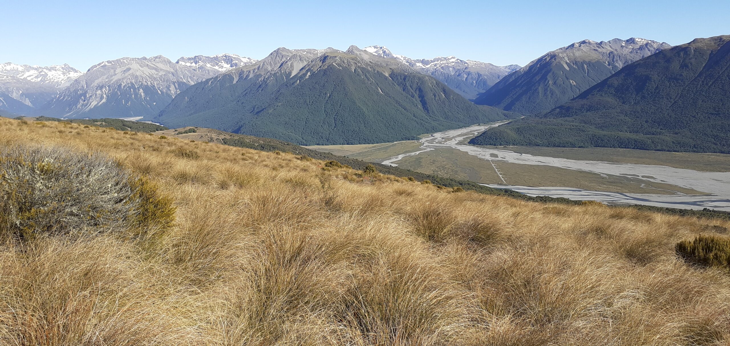
Day 46 started early with a lot of small ups and downs, through the forest in the valleys behind all of the Craigieburn ski fields like Cheeseman and Broken River. After this, a long gentle climb to Lagoon Saddle where the Waimakariri River appears in all its glory… and on such a fine day. I included the panoramic photo below as well to try and capture the magic.


Day 47 and after spending the night at Bealey Hut, it was a mostly easy walk down the the Waimakariri. The flow was not too intimidating, so I crossed it on foot without using the bridge. After the crossing, a couple of kilometer pars Klondyke Corner camping ground onto the 2202km market of the TA where I stopped. I had a friend that collected me and returned to Christchurch.


Back to 2024, the rest of my actual Tuesday was spent very laid back. I made a trip to the barber, to get my hair, and more importantly my beard back into shape. (I am still not completely “sold” on the beard thing… time will tell) I also made the decision to get a photo framed that I purchased back when I pasted through Wanaka. I asked the store owner to ship it to my home in Christchurch since I couldn’t carry it in my backpack. I think it will turn out great and I have a spot on the wall earmarked for it.
__________
43.5323 – 172.5567
9 April 2024
FP-89
2 responses to “Rakaia River to Arthur’s Pass – Day 44/47.”
This beard suits you extremely well!
Thank you for your kind words, like I said, not completely sold on it yet.